

[ad_1]
In the wake of concerns surrounding school safety and the need for a rapid response to active shooter situations, thousands of school districts across the United States have turned to digital mapping technology to bolster security.
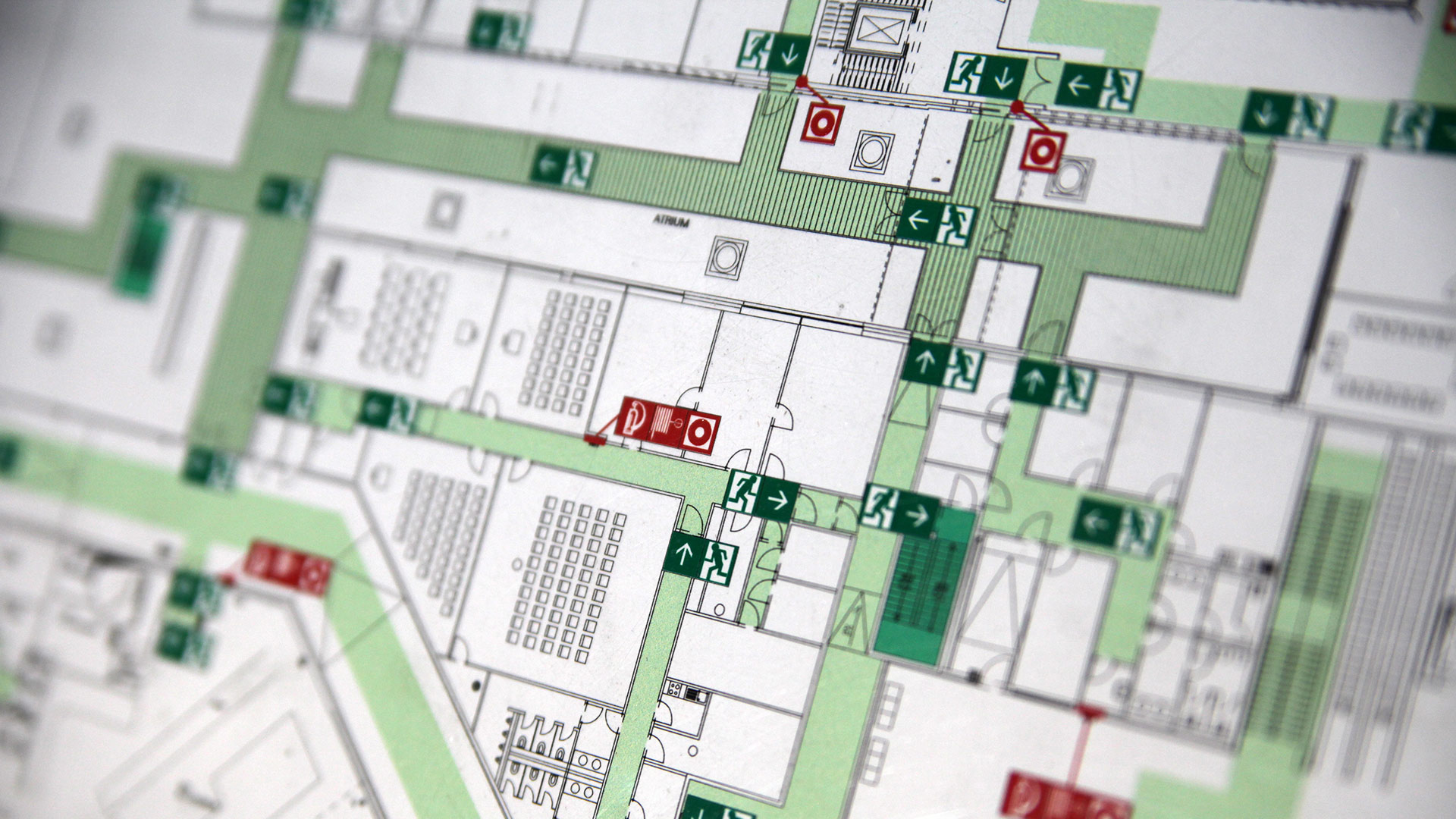
The technology has proven to be a critical tool for law enforcement, firefighters and medical professionals, enabling them to respond more effectively to emergencies ranging from intruders to mass shootings.
One such instance occurred recently at Kromrey Middle School in Wisconsin, where a motion detector set off an alarm one night. Due to the school’s digital mapping system, a police dispatcher was able to quickly pinpoint the detector’s location on a digital map of the building.
By accessing a live feed from the nearest camera, the dispatcher relayed the intruder’s exact location to responding police, leading to the immediate capture of a teenager who was found trespassing in the school.
Jim Blodgett, the school’s security director, noted the importance of this technology in preventing situations from escalating unnecessarily.
“The dispatcher could see that it looked like a student … just kind of goofing around in the building,” Blodgett told the Associated Press.
The middle school’s district, the Middleton-Cross Plains Area School District, was an early adopter of digital mapping technology, utilizing detailed digital maps produced by companies specializing in this area.
The district’s proactive approach has been followed by approximately 200 other districts in Wisconsin, thanks in part to mapping grants provided by the state.
Similar initiatives have since been implemented in more than 20 states nationwide, including Florida, Michigan and New Jersey, which have allocated millions of dollars in funding to support the creation of digital maps for every school in their respective states.
Leading the charge in this field is Critical Response Group, a New Jersey-based company founded by Army special operations veteran Mike Rodgers. The company has mapped over 12,000 schools nationwide, drawing on Rodgers’ military experience with gridded digital maps during deployments.
“When an emergency happens at a school or a place of worship, most likely it’s the first time those responders have ever gone there,” Rodgers explained. “They’re under a tremendous amount of stress and they’re working with people they’re not familiar with, which is exactly the same problem that the military is faced with overseas, and ultimately that’s why this technique was born.”
However, the adoption of digital mapping technology in schools has not been without its challenges.
Lobbying efforts from companies have played a significant role in shaping state laws and bills related to digital mapping standards, which has sparked competition among vendors. So far, Critical Response Group, Centegix, GeoComm and Navigate360 have collectively spent over $1.4 million on lobbying in 15 states.
Officials say that generating the maps can cost several thousands of dollars. But while the costs associated with implementing digital mapping technology can be significant, proponents argue that the benefits far outweigh the expenses.
Texas was so committed to the technology that, following the Uvalde shooting in 2022, legislators included mapping requirements in their $1 billion school safety initiative. The initiative also mandated that schools adopt panic buttons, as well as armed security officers.
Indeed, experts say that integrating digital maps with other security systems, such as wearable panic buttons, enhances their effectiveness in providing real-time information to emergency responders.
“If it’s not integrated with a crisis response system that can be pushed electronically to the dispatch center and police, then it’s probably not going to mean anything to them in the first minutes,” Jeremy Gulley, the superintendent of the Jay County, Indiana, school system, said. The schools in his district currently rely on Centegix mapping and alert systems.
Despite the advancements in digital mapping technology, there are concerns about the need for regular updates to ensure the accuracy of the information provided.
Furthermore, some states have enacted legislation to exempt digital school maps from public disclosure, citing security reasons.
“If bad people had access to the drawings, that would be almost worse than not knowing” a school’s layout, stressed Chuck Wilson, chair of the Partner Alliance for Safer Schools. “We’ve got to be really, really mindful of protecting this information.”
[ad_2]
